
[Home -> The Isle of Islay -> More 180° Quicktime VR Panoramas from Islay] [Contact] |
This is the second set of 180° Islay panoramas, for the first 25 please also see the first 180° Quicktime VR Panoramas from Islay page. I'm sure you'll like them as much as what you'll find on this page.
Most of my pictures from the Isle of Islay only show a small area. On this page I will collect pictures showing you a little bit more: 180° (or thereabouts) Quicktime VR Panoramas. To view them you will need the Apple QuickTime plugin installed on your PC. The previews on this page give you an impression of what to expect, follow the links under the previews for the full experience. Note: Most of the panoramas are quite big, depending on your connection speed they might take a while to download.

A panoramic view over Bowmore, Islay's ‘capital’ with its pier (2.9MB download). Port Charlotte and Beinn Tart a'Mhill are also visible on the Rinns of Islay on the other side of Loch Indaal. Taken on a bright morning in June 2007.

A panoramic view over Bowmore on the shore of Loch Indaal on Islay (3.2MB download). Taken on the same day as the one above in June 2007, but in the evening instead of the morning. A view of the whole village stretching along Loch Indaal, seen from across the loch.
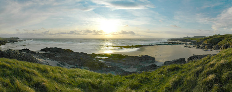
An evening at Saligo Bay on the west coast of Islay panorama (2.1MB download). Taken on a windy summer evening in June 2007, a good hour before sunset late in the evening. The view is from the dunes above Tràigh Flèisgein Mhòr.
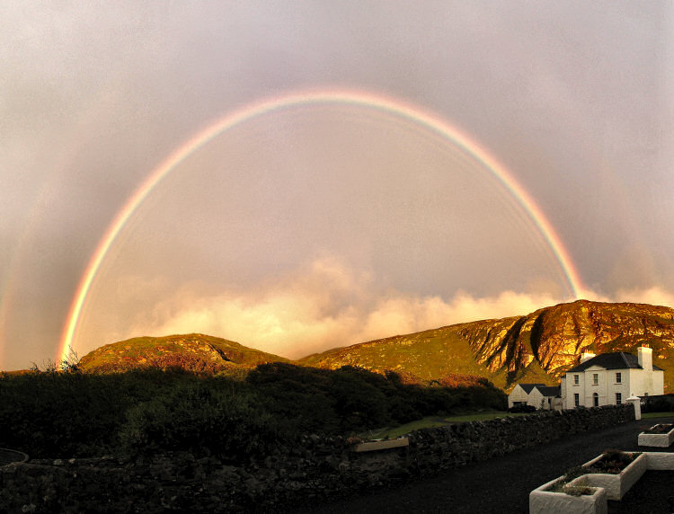
A panorama of a rainbow over Kilchoman on the west coast of Islay (1.2MB download), taken in June 2007. After a rainy afternoon suddenly the sun broke through, presenting me with this wonderful rainbow above the Kilchoman Crags and Kilchoman House.
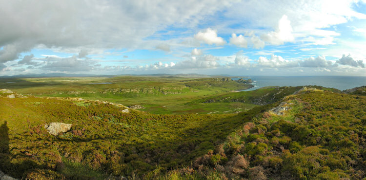
A panorama of a view over Gleann Tuath in the north west of Islay, taken on a summer evening in June 2007. Looking from the top of Cnoc Uamh nam Fear south towards the Rinn of Islay and two of the famous bays.

A panorama of a view over Sanaigmore Bay and the north of Islay from the hills above Sanaigmore Bay. Again looking from Cnoc Uamh nam Fear the view is mainly east, taking in a large part of the coastline as well as the hills in the north of Islay. Jura also visible on the horizon. Also taken in June 2007, same day as the one above.

A panorama of a view over Loch Indaal with Port Charlotte and Bowmore on the Isle of Islay, taken from Beinn Tart a'Mhill on the Rinns of Islay. The view is mainly north east, taking in a large part of the centre of Islay. Taken on a beautiful late afternoon in June 2007.

A panorama of a view over Kilchiaran and Machir Bay on the Isle of Islay with the haar (sea fog) moving in, taken from near the old RADAR installations above Machir Bay. The view goes all the way from Kilchiaran to Kilchoman including Machir Bay, Saligo and Loch Gorm. Taken on a beautiful June morning in 2010.

A panorama of a view over Port Charlotte at night, seen from the pier. The view takes in parts of Shore Street, the Port Charlotte Hotel, the Islay Youth Hostel and an anchored fishing boat. Taken in October 2010.
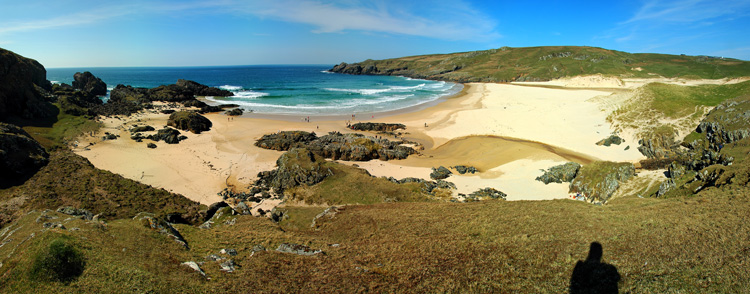
A panorama of a view over Lossit Bay on the west coast of Islay. The view takes in the whole bay and beach as well as large parts of the dunes. Taken in April 2010.

A panorama of a view over An Cladach bothy and the southern shore of the Sound of Islay. The view takes in the shoreline from McArthur's Head up to An Cladach bothy. Taken in April 2009.

A panorama of a view from Mala Bholsa (127m) on the north coast of Islay. The view takes in large parts of the northern shoreline of Islay as well as Colonsay, Oronsay and the Isle of Mull. Taken in June 2010.

A panorama of a view over Doodilmore River and Eas Lathan Waterfall in the north of Islay. The view takes in the river with the waterfall as it reaches the sea as well as Colonsay, Oronsay and the Isle of Mull across the sea. Taken in June 2010.

A panorama of a view over Port an Eas with its beach and waterfall at the south coast of Islay. The view takes in the beach with the waterfall and parts of the shoreline stretching out south west. Taken in June 2010.

A panorama of a view over the beach in Machir Bay on the west coast of Islay. The view takes in the beach with the dunes and the wreck as well as part of the shoreline stretching out south. Taken in April 2011.

A panorama of a view over Port Ellen and Texa on the south coast of Islay. The view takes in the Port Ellen Maltings, the village of Port Ellen, Laphroaig distillery, the island of Texa and Carraig Fhada lighthouse. Taken in June 2010.

A panorama of a view over the skerries on the south coast of Islay. The view takes in a large part of the skerries including Eilean a' Chùirn with the small lighthouse. Also in view the mainland and even Ireland on the horizon. Taken in April 2012.
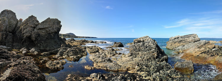
A panorama of a view over the rocky shore at Bholsa on the north coast of Islay, seen from right at the shore near Port a' Chotain (where the big cave is). The view takes in a section of the shoreline around Port an t-Sruthain as well as Mala Bholsa (127m). Also in view Colonsay and Oronsay in the north. Taken in April 2012.
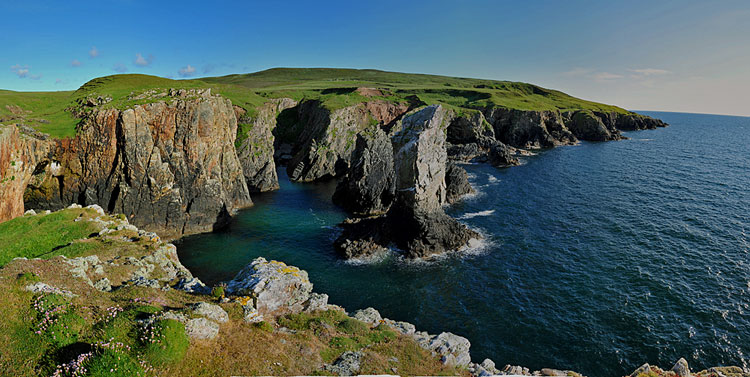
A panorama of a view over Soldier's Rock on The Oa in the south of Islay, seen from Slochd Maol Doiridh. The view takes in the sea stack known as Soldier's Rock and the surrounding coastline including the natural arch. Taken in June 2012.

A panorama of a view over Saligo River and Saligo Bay on the west coast of Islay, seen from the southern end of the bay. The view takes in the river crossing the beach and some of the rocky shoreline in the area. Taken in April 2012.

A panorama of a view from the cliffs at Sanaigmore over the north west of Islay, seen from above Port Carraig Sgàirn. The view takes in Sanaigmore Bay, the Paps of Jura in the distance and of course the steep cliffs at Port Carraig Sgàirn to name a few places. Taken in June 2012.
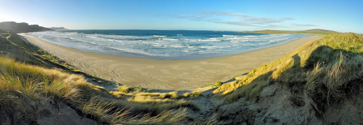
A panorama of a view from the dunes at Machir Bay on the west coast of Islay. The view takes in the whole beach from south to north. Taken in November 2012.
A panorama of a view from the dunes at the entrance to Machir Bay on the west coast of Islay. The view takes is from one of the paths from the car park, showing the first good view of the beach and bay. Taken in November 2012.

A panorama of a sunset over Islay seen from the ferry to Kennacraig in November. The view takes in the south coast of Islay under some beautiful red and orange clouds. Taken in November 2012.

A panorama of a view over the southern skerries near Ardilistry. The view takes in a number of the skerries including Eilean Mhic Mhaolmoire. Also the ‘lone Christmas tree’. Taken in June 2012.
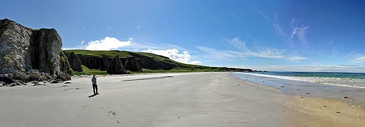
A panorama of a view over the beach at Bàgh an Dà Dhoruis, looking west. The view takes in the beach and surrounding cliffs and raised beaches. Taken in June 2013.
More panoramas will follow here
More to come over time, when I had the chance to take pictures and put them together into a panorama. If you have any suggestions please send me an e-mail and I'll see what I can do during one of my visits to Islay. If you liked these panoramas you might also be interested in some other panoramas from Islay. For more QuickTime VR panoramas you might also be interested in my 360° QTVR panoramas from Islay or my Islay Distillery Panoramas. For panoramas from Islay's nearest neighbour you can view the 180° Quicktime VR Panoramas from the Isle of Jura.
 |
Back to top
Copyright © 2008-2014 Armin Grewe - About - FAQ |
 |